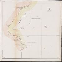
1. Map of the river Sabine from its mouth on the Gulf of Mexico in the sea to Logan's Ferry in Creator: Lee, Thomas Jefferson, 1808-1891 Published / Created: 1842?] Call Number: 796fab Sa13 1842H Container / Volume: BRBL_00530 Image Count: 5 Resource Type: Maps, Atlases & Globes Found in: Beinecke Rare Book and Manuscript Library > Map of the river Sabine from its mouth on the Gulf of Mexico in the sea to Logan's Ferry in latitude 31⁰, 58', 24" north, shewing the boundary between the United States and the Republic of Texas between said points, as marked and laid down by survey in 18